Richard Martin Gallery
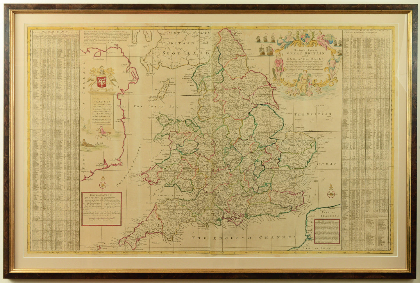
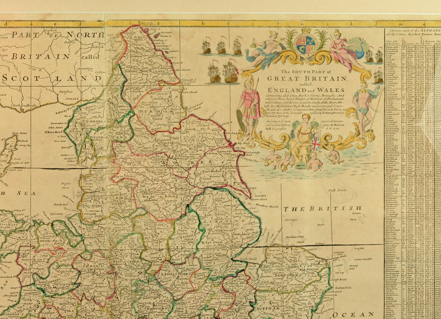
Antique Map of England and Wales by Herman Moll, c.1710
Antique Map of England and Wales by Herman Moll, c.1710
Couldn't load pickup availability
Herman Moll (mid 17th century - 1732)
The South Part of Great Britain, called, England and Wales..., dated 1710
fine engraved map, hand coloured
Handsomely framed and glazed in our studio with a conservation mount and chestnut-burl veneer frame, with gold sight edge
Herman Moll's large map of England and Wales is one of the most attractive early 18th century maps. There is an alphabetical index of principal towns to the left and right, and the post roads and crossroads are shown on the map with distances between towns clearly marked. The many counties of the county are shown, each hand-coloured in outline.
The main title cartouche is flanked by ships of England's maritime fleet, with other classical figures including Britannia.
Herman Moll was of German or Dutch origin and settled in England by the late 1670s. By the early 18th century he became the foremost map publisher in England, producing a wide variety of atlases and geographical works.
Shipping & Returns
Shipping & Returns
Free UK postage for items over £500 GBP
Otherwise calculated at checkout
Overseas postage calculated at checkout depending upon location
Returns
You have 30 days to return your item after receieving it. Returns can be made for any reason. Click below for more information.
Share